10 Best Marine Gps For Boat 2026 in the United States
Related Products
Up to 15% off
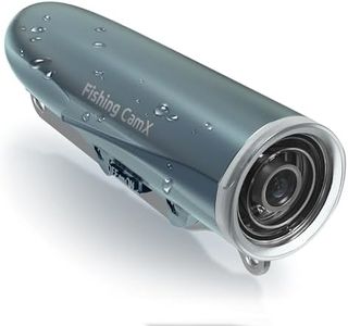
![[FishPRO® 2026 Upgrade] NO.1 HD 1080P Underwater Fishing Camera 7'' IPS- DVR-32GB, w/10,000mAh(Ease To Use), Ice Fishing Camera Underwater, Fish Finder Camera for Boat Ice Lake Fish, USB-C/LED+IR/82ft](https://images-proxy.bestreviews.guide/R_b1c0dzqWoOQ1l6wpTArbSAfYI=/0x300/https://m.media-amazon.com/images/I/51NDJYY8JZL._AC_CX679_.jpg)

Recommended lists

Marine Spotlight For Boats
Our technology thoroughly searches through the online shopping world, reviewing hundreds of sites. We then process and analyze this information, updating in real-time to bring you the latest top-rated products. This way, you always get the best and most current options available.
Our Top Picks
Winner
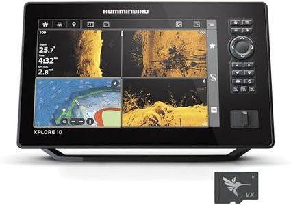
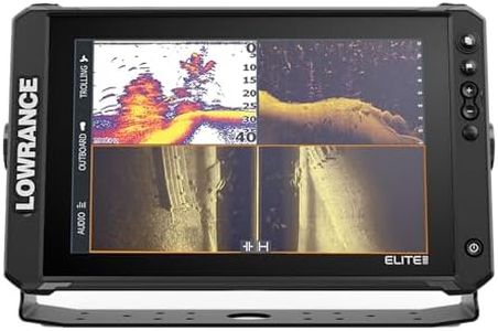
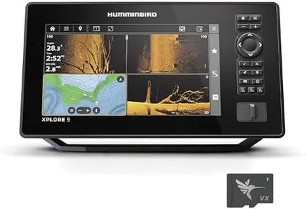
Humminbird XPLORE 10 GPS Fish Finder, MEGA Side Imaging+ & HD Touchscreen (Control Head Only)
Most important from
48 reviews
The Humminbird XPLORE 10 GPS Fish Finder is a solid choice for boaters who want a combination of advanced fish-finding sonar and reliable navigation features. Its 10.1-inch color touchscreen display is large enough for clear viewing and easy to operate with both touch and keypad controls. The built-in GPS uses an enhanced Basemap with over 10,000 lakes and coastal waters, plus detailed map cards for US and Canada, making it useful for recreational fishing and navigation in these regions. One standout is the AutoChart Live technology that lets you create real-time maps of your fishing spots, including depth and bottom conditions, which can be very helpful for serious anglers.
The device supports MEGA Side Imaging+ sonar with a 200-foot range on each side and MEGA Down Imaging+ up to 200 feet deep, providing clear underwater views to locate fish and structures. Connectivity is strong with Bluetooth for wireless anchor control and smartphone notifications, plus Ethernet and NMEA 2000 compatibility for integrating with other boat electronics. This model is sold as a control head only, so you’ll need to purchase a transducer separately to use the sonar features, which adds to the cost and setup complexity.
While the user interface is designed to be intuitive, some users new to marine electronics might face a learning curve with all the features. This unit is well-suited for anglers and boaters who want a feature-rich chartplotter combined with high-quality sonar and connectivity options but be prepared to invest in additional components and spend some time learning the system.
Most important from
48 reviews
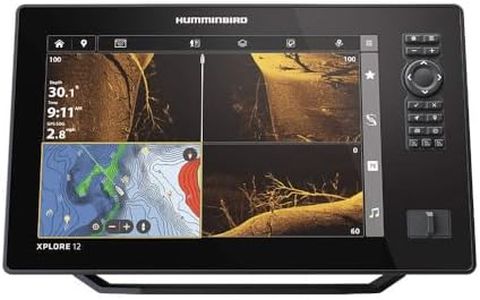
Humminbird XPLORE 12 GPS Fish Finder with Transducer, MEGA Side Imaging+ & HD Touchscreen
Most important from
93 reviews
The Humminbird XPLORE 12 is a strong choice for boaters and anglers who want detailed sonar and navigation features in one device. Its 12-inch full HD touchscreen offers clear, sharp visuals that make reading maps and sonar images easy, even in bright outdoor conditions. The device pairs touchscreen controls with physical buttons, giving more flexibility in different boating situations. It integrates well with popular chart systems, including Navionics and its own LakeMaster maps, covering thousands of lakes and coastal areas in the US and Canada. This means you get reliable GPS navigation along with real-time mapping updates via AutoChart Live, which is useful for tracking underwater features as you go. The GPS accuracy is solid and benefits from built-in recording to save your routes and map changes.
Its premium MEGA Side Imaging+ sonar covers a wide range and depths up to 200 feet, providing detailed underwater views, which is especially helpful for fishing. Connectivity features like Ethernet, Bluetooth, and NMEA 2000 compatibility allow easy networking with other marine electronics, including motor controls. However, the unit is somewhat heavy and bulky at over 6.5 kilograms, and the power source is corded, which means it requires a boat power supply and limits portability. Also, while it has a good waterproof rating, it’s best suited for mounted use rather than handheld. The interface is user-friendly but might take a little time to master for complete beginners due to the range of features.
This model is well suited for serious anglers or boaters who want advanced sonar and mapping combined with solid GPS navigation in one durable device.
Most important from
93 reviews
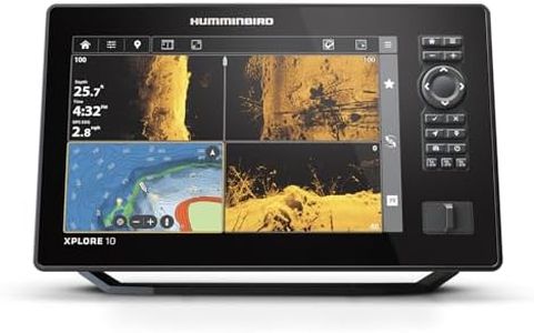
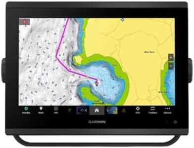
Humminbird XPLORE 10 GPS Fish Finder with Transducer, MEGA Side Imaging+ & HD Touchscreen
Most important from
93 reviews
The Humminbird XPLORE 10 GPS Fish Finder is designed to offer solid navigation and fish-finding capabilities for boaters and anglers. It features a large 10-inch high-definition touchscreen with a 1280 x 720 resolution, which makes reading maps and sonar images clear and easy. The dual control system, combining touchscreen and keypad, provides flexibility when operating in different conditions.
GPS accuracy is strong thanks to built-in mapping including a detailed Humminbird Basemap with 10,000+ lakes, plus LakeMaster, CoastMaster VX, and compatibility with popular Navionics charts. This makes it a versatile choice for both freshwater and coastal navigation.
Most important from
93 reviews
Buying Guide for the Best Marine Gps For Boat
Choosing the right marine GPS for your boat is crucial for ensuring safe and efficient navigation on the water. A marine GPS helps you determine your exact location, plan routes, and avoid hazards. When selecting a marine GPS, it's important to consider various specifications to find the best fit for your needs. Here are some key specs to look at and how to navigate them.FAQ
Most Popular Categories Right Now


